National Zoning Atlas: Zoning Code Standardization + Spatial Analysis
Structured translation of complex municipal zoning laws into analysis-ready geospatial datasets for equitable housing reform.
2024 - 2025
(NZA, Excel, Miro)
Geospatial Data Standardization and Analysis


Summary
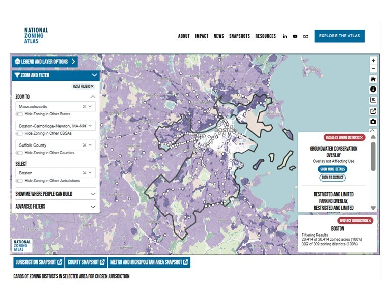
Contributed to the National Zoning Atlas, a nationwide initiative digitizing and standardizing zoning regulations across over 33,000 jurisdictions in the United States. Translated complex zoning codes and maps into structured geospatial datasets, supporting large-scale spatial analysis of land-use regulations and enabling transparent, data-driven planning, housing, and infrastructure research.

Approach
Zoning regulations in the U.S. exist as fragmented legal documents and inconsistent maps, making it difficult to analyze land-use constraints, housing capacity, and infrastructure planning at regional and national scales. The lack of standardized geospatial zoning data limits evidence-based planning and policy evaluation. Reviewed municipal zoning codes, planning documents, and official zoning maps to extract regulatory characteristics for zoning districts. Digitized and structured zoning information into standardized geospatial datasets using GIS. Created and corrected zoning district geometries, attribute tables, and metadata fields to ensure spatial accuracy, regulatory consistency, and integration into the National Zoning Atlas database.

Results
Developed structured geospatial zoning datasets enabling consistent spatial analysis across jurisdictions. Digitized and validated zoning district boundaries, attributes, and regulatory classifications. Improved spatial data completeness and accuracy, contributing to a national-scale zoning database supporting planning, housing, and infrastructure research.

Impacts
The National Zoning Atlas is the first nationwide effort to digitize and standardize zoning regulations, enabling researchers, planners, and policymakers to analyze land-use constraints at regional and national scales. This work supports housing policy reform, infrastructure planning, and land-use analysis by transforming fragmented regulatory information into accessible geospatial data.
The resulting datasets enable spatial modeling, planning analysis, and evidence-based policy decisions affecting urban growth, transportation systems, and housing development
Want to discuss more about
this project ?
